About Backroads Less Traveled maps

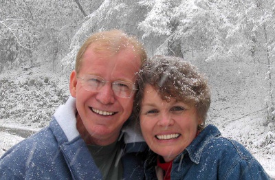
A family-owned and operated business, originally established by Dwight and Jeanne Matheny, Backroads Less Traveled Maps began as a labor of love. Creating specialized vacation maps to special places is a passion of ours which began with a longing to discover new places in the mountain areas we enjoyed. We wanted to lead people on the same types of fun, interesting and off-the-beaten path mountain adventures our family had experienced for decades. By combining our lifelong love of geography, topography, nature and artistic design, mapmaking was a next natural step.
Our first goal was to create a detailed map of North East Georgia waterfalls, hiking trails, fishing spots, back roads and streams that would go far beyond any map that had ever been seen. It was truly a labor of love, taking a year of research – and more than 200 sources of information – just to catalog our favorite places, interview locals, and find new, little-known hotspots.
Finally, after hundreds of hours of work, our first map of North East Georgia was complete and ready for distribution in July 2009. The response from the public was more than we ever expected – and in more than 10 years, many thousands of people have taken to the Mountains with our maps! Their feedback tells us that it is the most accurate map they have ever used for this region.
Since then, Backroads Less Traveled Maps has expanded its products and created three more maps, of Western North Carolina, of South East Tennessee and of the The Benton MacKaye Trail. The Benton MacKaye Trail Map was created in cooperation with, edited and approved by the Benton MacKaye Trail Association.
We keep our maps up-to-date and are constantly searching out new places to help you enjoy your time as you explore the territory covered by our maps. We hope our maps bring you many hours of adventure, as well as many beautiful memories for you and your loved ones.