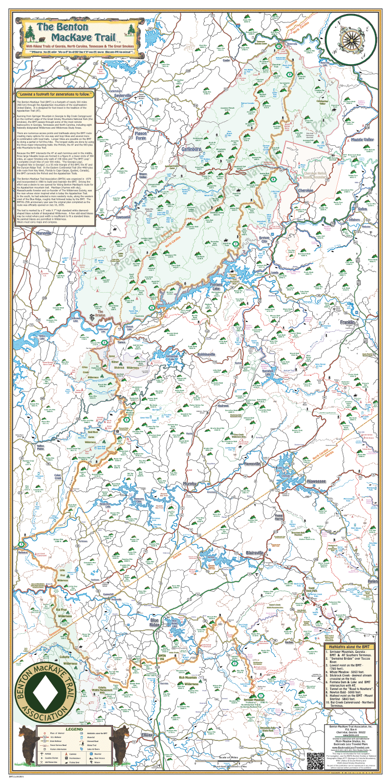
Description
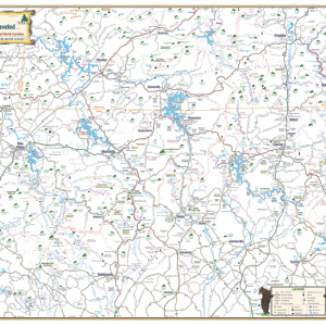
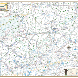
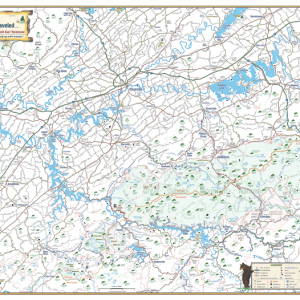
Our Benton MacKaye Trail Display Map, created in cooperation with the Benton MacKaye Trail Association (BMTA), highlights the BMT along with 10 scenic points on the Trail. This nearly 300 mile footpath runs from Springer Mountain in Georgia to Big Creek Campground at the NE corner of the Great Smoky Mountains National Park. It passes through some of the most remote and scenic backcountry in Georgia, Western North Carolina and Tennessee. Our BMT map shows you where the Appalachian Trail intersects with the Benton MacKaye Trail, creating the 3 loops many avid hikers love to hike. You’ll also find the main highways, waterfalls, some of the backroads and short cuts along with mountain peak names and elevations. It is drawn to scale and is easy to read.
Map size is 36 “ high X 18 “ wide.
Backroads Less Traveled donates a portion of all Benton MacKaye Map sale proceeds to the BMTA to help maintain and preserve the trail. More information can be found on the Benton MacKaye Trail Association at www.bmta.org.
Towns and Communities
Georgia
- Blairsville
- Blue Ridge
- Cherrylog
- Ellijay
- Helen
- Hiawassee
- McCaysville
- Suches
- Young Harris
North Carolina
- Andrews
- Brasstown
- Bryson City
- Cherokee
- Dillsboro
- Franklin
- Hayesville
- Lauda
- Maggie Valley
- Marble
- Murphy
- Robbinsville
- Sylva
- Tapoco
- Topton
- Waterville
- Webster
Tennessee
- Coker Creek
- Copperhill
- Cosby
- Ducktown
- Gatlinburg
- Maryville
- Pigeon Forge
- Reliance
- Sevierville
- Tellico Plains
- Townsend
- Turtletown
- Wears Valley
Hiking Trails
- Benton MacKaye Trail
- Appalachian Trail
- Bartram Trail
- Beech Gap Trail
- Duncan Ridge Trail
- John Muir Trail
- Lakeshore Trail
- Mountain-to-Sea Trail
- Mt. Sterling Ridge Trail
- Pinhoti Trail
- and More
Waterfalls – Georgia
- Amicalola Falls
- Anna Ruby Falls
- Black Falls
- DeSoto Falls
- Dukes Creek Falls
- Fall Branch Falls
- Haynes Falls
- Helton Creek Falls
- Hemlock Falls
- High Shoals Falls
- Horse Trough Falls
- Long Creek Falls
- Mill Creek Falls
- Raven Cliff Falls
- Sea Creek Falls
Waterfalls – North Carolina
- Bartram Falls
- Big Falls
- Big Laurel Falls
- Burningtown Falls
- Flat Creek Falls
- Gunter Fork Falls
- Indian Creek Falls
- Juneywhank Falls
- Kennedy Falls
- Leatherwood Falls
- Little Creek Falls
- Middle Falls
- Mooney Falls
- Mouse Creek Falls
- Queens Falls
- Rufus Morgan Falls
- Sassafras Falls
- Soco Falls
- Tom Branch Falls
- Twenty Mile Cascade
- Upper Falls
Waterfalls – Tennessee
- Abrams Falls
- Bald River Falls
- Coker Creek Falls
- Conasauga Falls
- Fern Branch Falls
- Grotto Falls
- Hen Wallow Falls
- Huskey Branch Falls
- Indian Flats Falls
- Laurel Falls
- Lynn Camp Prong Falls
- Rainbow Falls
- Ramsay Cascades
- Spruce Flats Falls
- The Sinks
- Towee Falls
- Upper Bald River Falls
- Wilson Falls
Creeks, Lakes, and Rivers
- Abrams Creek
- Apalachia Lake
- Cartecay River
- Calderwood Lake
- Cheoah Lake
- Cherokee Lake
- Citico Creek
- Citico Creek, North Fork
- Citico Creek, South Fork
- Coker Creek
- Ellijay River
- Etowah River
- Fightingtown Creek
- Fontana Lake
- Goose Island Lake
- Hiwassee Lake
- Hiwassee River
- Indian Boundary Lake
- Jacks River
- Lake Blue Ridge
- Lake Chatuge
- Lake Emory
- Little Lost Creek
- Little River
- Little Tennessee River
- Nantahala Lake
- Nantahala River
- Noontootla Creek
- Nottely Creek
- Ocoee River
- Santeetlah Lake
- Slick Rock Creek
- Tellico Lake
- Tellico River
- Toccoa River
- Towee Creek
- Tuckasegee River
- Waterville Lake
Wilderness Areas
- Bald River Gorge Wilderness
- Big Frog Wilderness
- Citico Creek Wilderness
- Cohutta Wilderness
- Cooper’s Creek Wildlife Management Area
- Fires Creek Wilderness Area
- Joyce Kilmer Slickrock Wilderness
- Little Frog Wilderness
- Rich Mountain Wilderness